Dumas grew up where the railroad crossed the 940-acre farm of W. B. Dumas in the Arkansas Delta. Dumas had bought the farm from the Holmes family, and when the tracks came through he surveyed the area and the town that took his name began to take shape. It was incorporated in 1904. Cotton was the primary crop, and farming and ginning built the town’s economy.
During World War II the federal government held incarcerated Japanese Americans at the Rohwer War Relocation Center in Desha County. This page collects dated maps, photos and public records from that history, with a link to every source.
Maps through the years
Sanborn fire insurance maps show Dumas building by building: pink for brick, yellow for frame. Here is the first sheet of each edition in the Library of Congress collection, from 1913 to 1918, followed by a recent photo. Swipe or scroll sideways to see them all, and select a map to open it full size.
June 1913
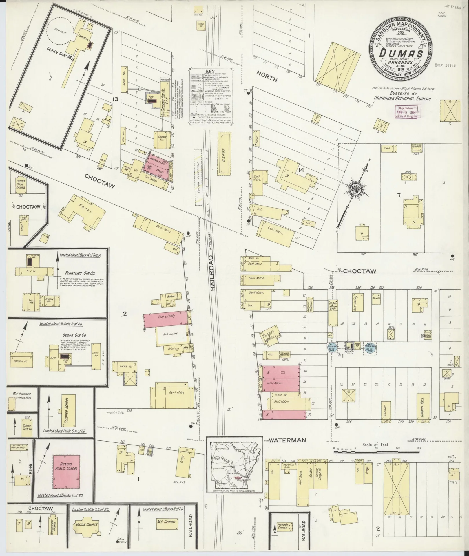
April 1918

Now, 2020

Business and industry
- Merchants: D. O. Porter, a plantation manager, moved to Dumas in 1893 and between 1905 and 1938 built five buildings on the east side of Main Street, including the Hagood Building (1938). Charles Dante, a Jewish immigrant from Poland, came in 1894 as a peddler, opened a store by 1897 and built it into the Globe Store; around 1925 he moved it into what became Dante’s Department Store. AHPP Dumas walking-tour script
- Bank: The Merchants and Farmers Bank was chartered in 1909 to replace the failing Bank of Dumas, and in 1913 it put up its building, designed by Charles Thompson, on the old bank’s site. AHPP Dumas walking-tour script
- Cotton, timber and industry: The WPA guide described Dumas in 1941 as primarily a cotton town, with part of the population working at a sawmill and Missouri Pacific Valley Line tracks running down the middle of Main Street. The walking-tour script notes the jobs lost after the 1955 fire at the Georgia-Pacific mill and later employers including Dantan Company, United Dollar Store (later sold to Dollar General), Puryear Wood Products, Sunbeam, Southern Catfish Processors, Delta Bottle Works and Smith Steel Products. Arkansas: A Guide to the State (Writers' Program, WPA, 1941)
Landmarks
- Merchants & Farmers Bank, Waterman and Main Sts.: Listed in 1982 for state-level significance in architecture, this building is recorded by the NPS with Classical Revival styling, design or construction credited to Charles L. Thompson and key year 1913 (nominated under the Thompson, Charles L., Design Collection TR). National Park Service
- McKennon-Shea House, 206 Waterman St.: Listed in 1993 for local-level significance in commerce and agriculture, this building is recorded by the NPS with Classical Revival styling, design or construction credited to Robert A. Culpepper and a period of significance of 1900-1924 and 1925-1949. National Park Service
- Dr. J. D. Watts House, 205 W. Choctaw: Listed in 1994 for local-level significance in architecture, this building is recorded by the NPS with Queen Anne and Colonial Revival styling and a period of significance of 1900-1924. National Park Service
- Dumas Commercial Historic District, South Main St. bet. Choctaw and Waterman Sts.: Listed in 2007 for local-level significance in architecture and commerce, this district is recorded by the NPS with Colonial Revival and Early Commercial styling and key years 1905 and 1957. National Park Service
- Dante House, 501 Court St.: Listed in 2020 for local-level significance in architecture, this building has no style, architect or key date in the NPS index record. National Park Service
- Rohwer Relocation Center Site, Rohwer (Desha County): Site of the World War II camp. Listed on the National Register in 1974. National Park Service
- Rohwer Relocation Center Memorial Cemetery, Rohwer (Desha County): The camp cemetery and its monuments, built by people held at Rohwer. A National Historic Landmark since 1992. National Park Service
Notable people
- Gus Waterman: A Jewish immigrant from Germany, he became the first mayor and postmaster of Dumas when the town was incorporated in 1904. Encyclopedia of Arkansas
- John H. Johnson: Born in Arkansas City, the Desha County seat, in 1918, he founded Johnson Publishing, publisher of Ebony and Jet magazines. John H. Johnson Museum
Last checked Oct. 18, 2026.
Key facts
- Dumas was incorporated in 1904. Its first mayor was Gus Waterman. (Source: National Register nomination, Dumas Commercial Historic District)
- Before mechanization, it took between 1,000 and 1,200 mules to farm the Pickens acreage near Dumas, according to the district's National Register nomination. (Source: National Register nomination, Dumas Commercial Historic District)
- The Rohwer War Relocation Center in Desha County held as many as 8,475 incarcerated Japanese Americans. (Source: National Park Service)
- The Equal Justice Initiative documents 9 racial terror lynchings of Black people in Desha County between 1877 and 1950. EJI counts only cases it could document, so the figure is a minimum. (Source: Equal Justice Initiative, Lynching in America county data (updated November 2024))
- In 1941 the WPA guide described Dumas as primarily a cotton town, with part of the population employed by a sawmill. (Source: Arkansas: A Guide to the State (Writers' Program, WPA, 1941))
Timeline
The railroad comes through
The Little Rock, Mississippi River and Texas Railroad lays the first rail line through Dumas, according to the Arkansas Historic Preservation Program's Dumas walking-tour script. The St. Louis, Iron Mountain and Southern later buys the line, which is now part of the Union Pacific.
D. O. Porter arrives
Plantation manager David Oscar Porter moves to Dumas. Between 1905 and 1938 he builds five buildings on the east side of Main Street.
Charles Dante
Charles Dante, a Jewish immigrant from Poland, moves to Dumas as a peddler. By 1897 he opens a store, which grows into the Globe Store.
Dumas is incorporated
Dumas is incorporated. Its first mayor is Gus Waterman, a young Jewish immigrant from Germany.
c. 1905
First Porter Building
The first Porter Building goes up on Main Street. It is the oldest building in the Dumas Commercial Historic District, according to the walking-tour script.
Merchants and Farmers Bank
The Merchants and Farmers Bank is chartered to replace the failing Bank of Dumas. Its building, designed by Charles Thompson, goes up on the same site in 1913.
McKennon Supply Co.
Claude McKennon and R. B. Malone buy out J. H. Davis's share of their gin company and establish McKennon Supply Co.
Sanborn map of Dumas
The Sanborn Map Company draws a fire insurance map of Dumas in June 1913. Later editions follow in 1918, 1928 and 1943 (see the photos below).
Electricity comes on
Electricity is first turned on in Dumas the same day Meador Pharmacy opens. At first the power runs only from noon until midnight.
c. 1925
Dante's Department Store
Dante's Department Store is built to house the growing Globe Store.
The Great Flood
During the Mississippi River flood of 1927, water approached Dumas from the north, but the Kerch Canal between Dumas and Gould saved the town, according to the Encyclopedia of Arkansas. The Red Cross ran its Desha County relief headquarters from the Greystone Hotel in McGehee, according to a flood survivor's account held by the University of Arkansas.
Cotton farming is mechanized
R. A. Pickens II takes over his family's plantation, which the district's National Register nomination calls the largest in Desha County, and the farm is mechanized under his leadership.
Hagood Building
D. O. Porter builds the Hagood Building on Main Street.
Rohwer War Relocation Center opens
The War Relocation Authority opens the Rohwer War Relocation Center in Desha County. It holds as many as 8,475 incarcerated Japanese Americans, most from Los Angeles and San Joaquin counties in California. More than 10,000 people passed through the camp, and more than two-thirds of them were U.S. citizens, according to the National Park Service. The camp closes Nov. 30, 1945, according to the Densho Encyclopedia.
People from Jerome are moved to Rohwer
When the Jerome camp in Chicot and Drew counties closes in the summer of 1944, about 2,500 people held there are transferred to Rohwer, according to the Densho Encyclopedia.
A million-dollar cotton crop
C. R. McKennon makes headlines across the region by selling his cotton crop for $1 million in New Orleans.
Georgia-Pacific mill fire
Dumas loses jobs after a fire at the Georgia-Pacific mill, according to the walking-tour script.
United Dollar Stores
Bernard J. Tanenbaum, who married Charles Dante's daughter Naomi, founds United Dollar Stores at the site of Dante's Department Store. Run from an office and warehouse in Dumas, it grows to 242 stores and is later sold to Dollar General.
Rohwer camp site is listed
The Rohwer Relocation Center Site and its memorial cemetery are listed on the National Register of Historic Places.
Rohwer cemetery becomes a National Historic Landmark
The Rohwer Relocation Center Memorial Cemetery is designated a National Historic Landmark. The National Park Service calls it one of only three surviving cemeteries at Japanese American confinement sites. People held at the camp designed and built it, including a monument to those who died there.
Downtown joins the National Register
The Dumas Commercial Historic District, on South Main Street between Choctaw and Waterman streets, is listed on the National Register.
Photos
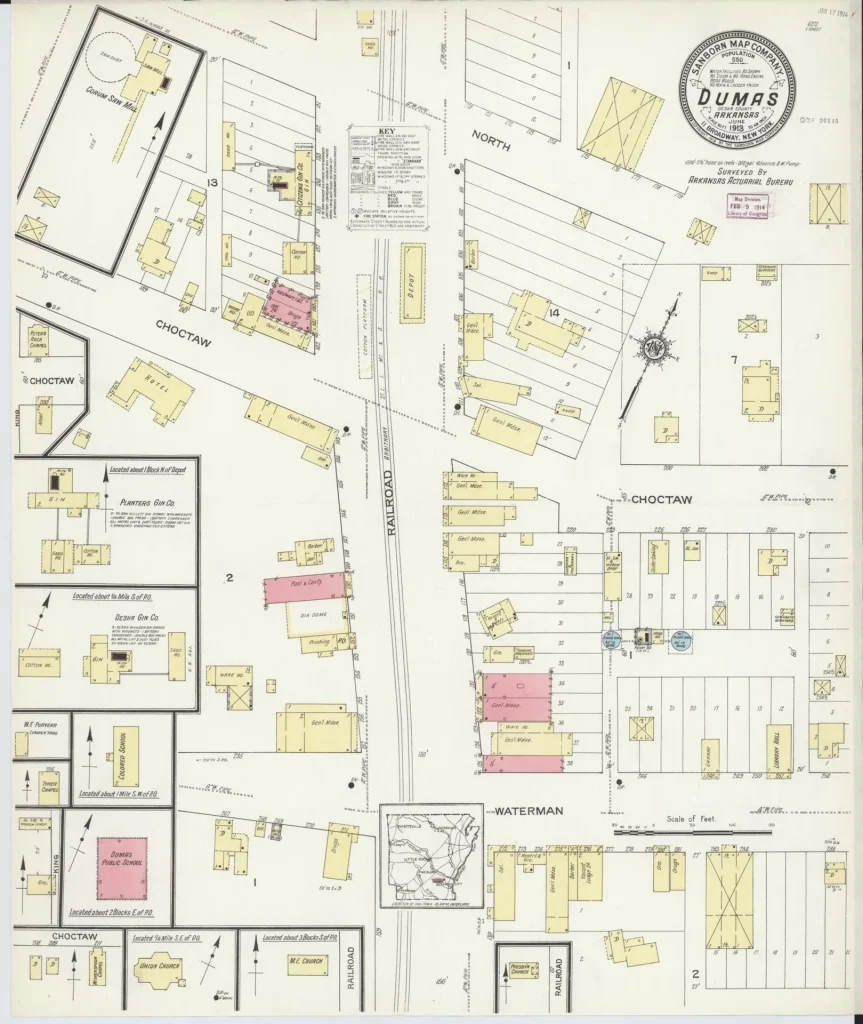
Index sheet of the June 1913 Sanborn fire insurance map of Dumas. Photo: Library of Congress, Geography and Map Division, Sanborn Maps Collection, June 1913. Public domain (per Library of Congress). Source A block of downtown Dumas. Photo: Carol M. Highsmith, Library of Congress, Prints and Photographs Division, Nov. 13, 2020. No known restrictions on publication (per Library of Congress). Source 
The Merchants and Farmers Bank building. Photo: Brandonrush, Wikimedia Commons, May 14, 2014. CC BY-SA 3.0. Source 
Dr. J. D. Watts House, 205 W. Choctaw St. Photo: Brandonrush, Wikimedia Commons, May 14, 2014. CC BY-SA 3.0. Source 
McKennon-Shea House, 206 Waterman St. Photo: Brandonrush, Wikimedia Commons, May 14, 2014. CC BY-SA 3.0. Source 
At the Rohwer Relocation Center Memorial Cemetery, a monument built by people held at the camp honors Japanese American soldiers of the 100th Battalion and 442nd Regimental Combat Team killed in Italy and France. Photo: Brandonrush, Wikimedia Commons, May 14, 2014. CC BY-SA 3.0. Source 
Concrete headstones at the Rohwer Relocation Center Memorial Cemetery. Photo: Brandonrush, Wikimedia Commons, May 14, 2014. CC BY-SA 3.0. Source 
The April 1918 Sanborn fire insurance map of Dumas, a single sheet. Photo: Library of Congress, Geography and Map Division, Sanborn Maps Collection, April 1918. Public domain (per Library of Congress). Source


Sources
- Dumas Commercial Historic District, National Register nomination (2007), National Park Service, NPGallery. Accessed .
- War Relocation Centers, National Park Service. Accessed .
- Rohwer Relocation Center Memorial Cemetery, National Park Service. Accessed .
- Rohwer (Brian Niiya), Densho Encyclopedia. Accessed .
- Dumas walking tour script (2017), Arkansas Historic Preservation Program. Accessed .
- Dumas (Desha County), Encyclopedia of Arkansas. Accessed .
- Lynching in America: county data supplement (updated November 2024), Equal Justice Initiative. Accessed .
- Confinement and Ethnicity: An Overview of World War II Japanese American Relocation Sites, Chapter 11: Rohwer Relocation Center, National Park Service (Burton et al., 1999). Accessed .
- Rohwer Relocation Center Memorial Cemetery (NRIS 92001882), National Park Service, NPGallery. Accessed .
- Sanborn Fire Insurance Map from Dumas, Desha County, Arkansas, June 1913, Library of Congress. Accessed .
- A block of downtown Dumas, Arkansas (Carol M. Highsmith, 2020), Library of Congress. Accessed .
- Arkansas: A Guide to the State (Writers' Program of the Work Projects Administration, 1941), Internet Archive. Accessed .