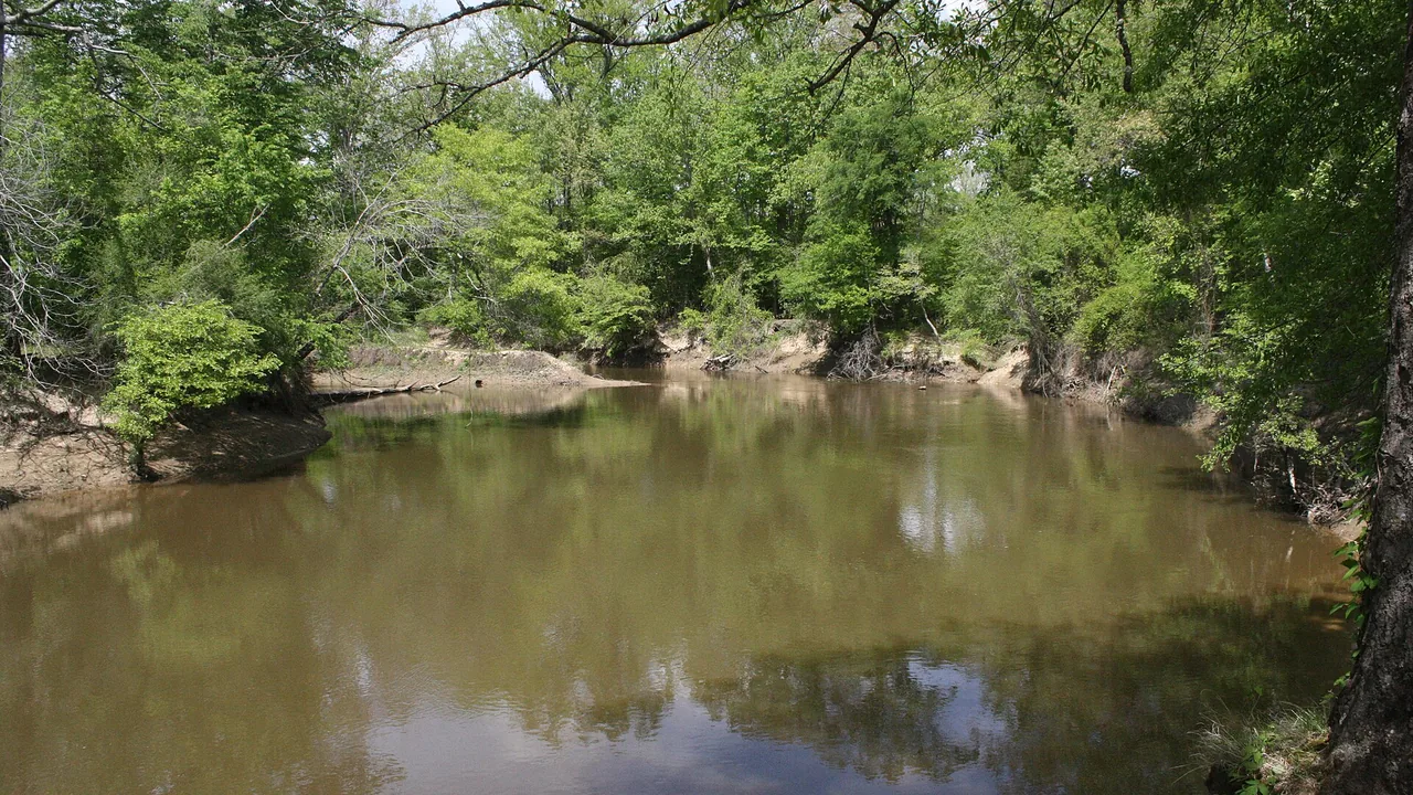
The Saline River north of Warren is running below its lowest mid-October levels in nearly 90 years of federal records, as extreme drought covers all of Bradley and Drew counties.
iSEARK.com publisher Keith Chambers crossed the U.S. Highway 278 bridge over the Saline between Warren and Monticello on Friday and saw the river “almost dry.” U.S. Geological Survey gauge data back up what he saw.
What the river gauge shows
The USGS gauge on the Saline River near Rye, north of Warren and upstream of the U.S. 278 bridge, measured about 11 cubic feet per second Friday afternoon. The water level at the gauge read about 4 feet.
- Normal for the date: The median flow for Oct. 16 is 91 cubic feet per second, based on 89 years of records that start in 1938. Friday’s flow is about one-eighth of that.
- Below the old lows: Daily average flows from Oct. 9 through Oct. 15 each came in below the lowest flow USGS had on record for that date. Friday’s reading sits near the Oct. 16 record low of 11 cubic feet per second, set in 1939.
- Slow decline: The river averaged about 20 cubic feet per second on Sept. 15. It has dropped on most days since late September.
- Early numbers: USGS labels recent readings provisional. They can be revised after review.
Drought Monitor shows extreme and exceptional drought
The U.S. Drought Monitor map released Thursday puts every part of Bradley and Drew counties in extreme drought, the second-worst category. Exceptional drought, the worst category, now covers parts of both counties.
- Bradley County: All extreme drought, with exceptional drought on about 12 percent of the county, home to Warren and Hermitage. None of Bradley was in exceptional drought a week earlier.
- Drew County: All extreme drought, with exceptional drought on about 16 percent of the county.
- Ashley and Cleveland counties: All extreme drought, including Crossett, Hamburg and Rison.
- Chicot and Desha counties: Exceptional drought covers about 24 percent of Chicot and 33 percent of Desha, home to Lake Village and Dumas.
Burn bans across Southeast Arkansas
The Arkansas Forestry Division listed burn bans in 49 counties as of Friday morning. Bradley, Drew, Ashley, Chicot, Cleveland, Desha, Lincoln and Dallas counties are all on the list. The division also rates each of those counties at extreme wildfire risk.
County judges set burn bans. Check with your county judge’s office before any outdoor burning.
Red Flag Warning still in effect
The dry river comes during a Red Flag Warning for critical fire weather. The National Weather Service warning covers Bradley, Drew, Desha, Ashley and Chicot counties until 8 p.m. Friday. Ashley and Chicot counties stay under a second warning from 11 a.m. to 7 p.m. Saturday. Details are in iSEARK.com’s Red Flag Warning story.
What residents can do
- Skip outdoor burning: The Arkansas Department of Agriculture asks people to avoid campfires, trash burning and open-flame grilling while the bans are in place.
- Use care on the river: Low water can leave logs and sandbars just under the surface. Check the depth before launching a boat.
- Report a wildfire: Call 911 or the Forestry Division at 1-800-468-8834.
Primary sources: USGS Water Data for gauge 07363500, Saline River near Rye, Ark. (provisional readings and daily flow statistics, accessed Oct. 16, 2026); U.S. Drought Monitor county statistics for the map dated Oct. 13, 2026; Arkansas Forestry Division Wildfire Danger and Burn Bans page as of 8:26 a.m. Oct. 16, 2026; National Weather Service Little Rock and Jackson Red Flag Warnings issued Oct. 16, 2026.